Map of elevation changes: quick-looks

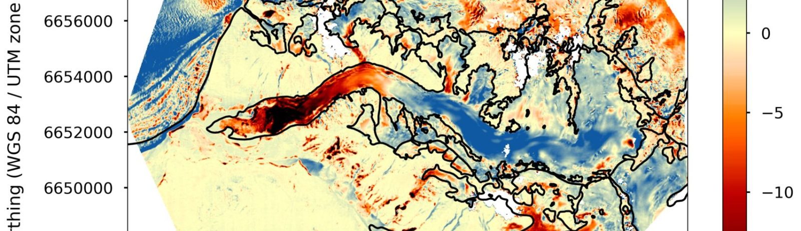
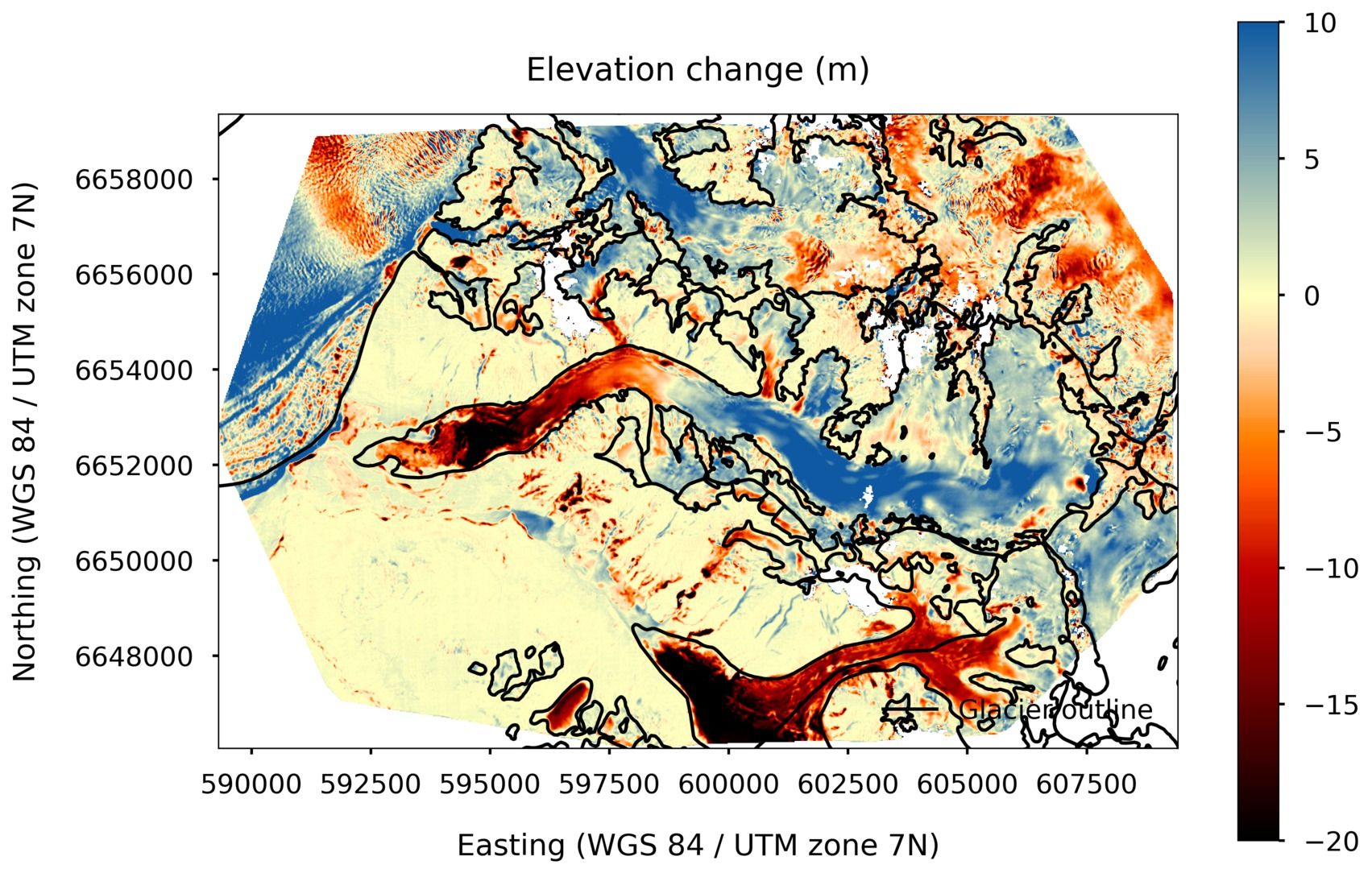
The ultimate PGO products are the maps of glacier elevation changes over 5-yr periods. They will soon be available on a web server. To keep you waiting, find below a gallery of such maps for 2016-2021, 2017-2022 or 2018-2023. Maybe you can spot your favorite glacier? [click on the first image to start the slideshow]

Red (thinning) clearly dominates…

Plus d'actualités

2025 north hemisphere campaign processed : new maps of elevation changes

Each semester, the two Pléiades satellites revisit several PGO sites (typically between 10 and 20). Comparison with previous surveys (dating back 5 years or more) enables new maps of elevation changes to be generated. We have just finished processing the 2025 stereo pairs for the northern hemisphere and have estimated the altitude changes of glaciers […]

3D animations of future glacier retreat using PGO data

A High-Level International Conference on Glaciers’ Preservation was held from 29 to 31 May 2025 in Dushanbe, Tajikistan. The conference was organized by the Government of the Republic of Tajikistan in cooperation with the United Nations and other development partners, in support of the International Year of Glaciers’ Preservation (2025). The principal aims were to […]

Beyond Pléiades. 4D-Earth ?

Pléiades will be flying until 2026, maybe slightly later. Another key stereo mission, ASTER on-board TERRA, will stop acquiring images in 2026 or 2027. A large scientific community (in particular glaciologists) is worried about the lack of follow up stereo missions. See here a Letter to the Editor in Nature. This is why we propose […]

Rechercher