2026 south hemisphere images processed : new maps of elevation changes
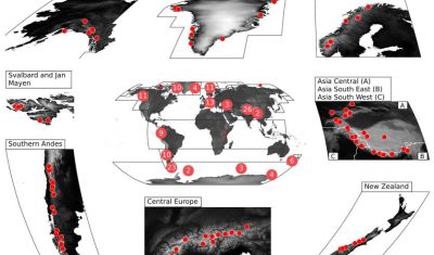
Each semester, the two Pléiades satellites revisit several PGO sites (typically between 10 and 20). Comparison with previous surveys (dating back 5 years or more) enables new maps of elevation changes to be generated. We have just finished processing the 2026 stereo images for the southern hemisphere and have estimated the changes of multiple glaciers […]
2025 north hemisphere images processed : new maps of elevation changes
Each semester, the two Pléiades satellites revisit several PGO sites (typically between 10 and 20). Comparison with previous surveys (dating back 5 years or more) enables new maps of elevation changes to be generated. We have just finished processing the 2025 stereo images for the northern hemisphere and have estimated the changes of glaciers in […]
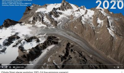
3D animations of future glacier retreat using PGO data
A High-Level International Conference on Glaciers’ Preservation was held from 29 to 31 May 2025 in Dushanbe, Tajikistan. The conference was organized by the Government of the Republic of Tajikistan in cooperation with the United Nations and other development partners, in support of the International Year of Glaciers’ Preservation (2025). The principal aims were to […]
Beyond Pléiades. 4D-Earth ?
Pléiades will be flying until 2026, maybe slightly later. Another key stereo mission, ASTER on-board TERRA, will stop acquiring images in 2026 or 2027. A large scientific community (in particular glaciologists) is worried about the lack of follow up stereo missions. See here a Letter to the Editor in Nature. This is why we propose […]
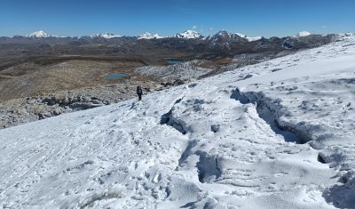
PGO data help to guide fieldwork in the Andes
We are delighted to read that Pléiades ortho-images and DSM were useful to guide a recent field campaign on the Quelccaya Ice Cap. PGO data will certain be also useful for the science to come out of these field observations. Congrtulation to the Deplete and Retreat: Andes Water Towers team.
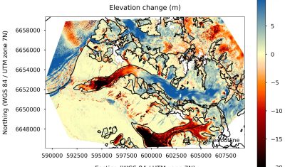
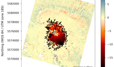
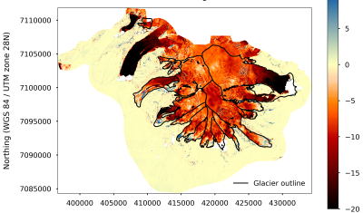
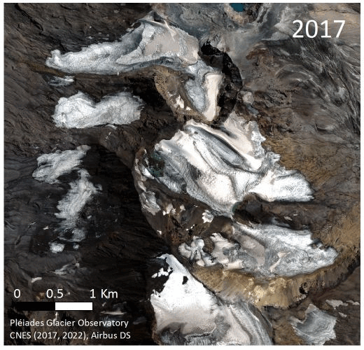
Map of elevation changes: quick-looks
The ultimate PGO products are the maps of glacier elevation changes over 5-yr periods. They will soon be available on a web server. To keep you waiting, find below a gallery of such maps for 2016-2021, 2017-2022 or 2018-2023. Maybe you can spot your favorite glacier? [click on the first image to start the slideshow] […]
Mandal et al.: Glacier mass balance and its climatic and nonclimatic drivers in the Ladakh region during 2000–2021 from remote sensing data
Ladakh region in the western Himalaya relies heavily on meltwater from glaciers and snow covers, particularly during spring season and dry years, due to its arid climate conditions. In our recently published paper (reference below), we estimated the geodetic mass balance of nearly all Ladakh glaciers using SRTM and ASTER DEMs for the period 2000-2021. […]
A pre-print describing the PGO program is online for public discussion & review
We just submitted to The Cryosphere (EGU) a manuscript describing the Pléiades Glacier Observatory (PGO) initiative, the data provided to the community. An effort was made to assess the precision of the topographies and elevation change maps derived from these data, in particular using synchronous Lidar data from Norway and Canada. A pre-print is available […]
Kneib et al.: Controls on ice cliff distribution and characteristics on debris-covered glaciers
Ice cliff distribution plays a major role in determining the melt of debris-covered glaciers but its controls are largely unknown. We used 14 Pléiades images, the majority of which were provided by the Pléiades Glacier Observatory (PGO), to assemble a data set of 37,537 ice cliffs and determine their characteristics across 86 debris-covered glaciers within […]
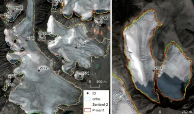
Andreassen et al.: Validation of Sentinel-2 based glacier mapping in Norway using Pléiades satellite orthoimages
In this study Sentinel-2 satellite imagery at 10 m resolution was used to map the extent of Norway’s glaciers and ice-marginal lakes over 2018–19. A standardized semi-automated band ratio method was applied to derive glacier outlines and ice-marginal lakes. The Sentinel-2 derived outlines were checked with very high-resolution aerial orthophotos and Pléiades satellite orthoimages. Glaciers […]
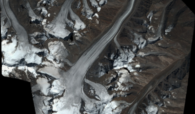
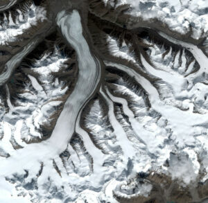
Repeat Pléiades images over the Andes
Since 2021, the PGO has entered a « revisit » mode. In other words, the Pleiades satellites photograph the same glaciers 5 years later to study their change in extent and volume. Thus, in February and March 2022, Pleiades acquired stereo images of about 15 glaciated sites in the Southern Hemisphere that had already been observed in […]
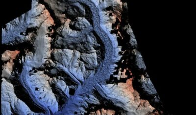
Last acquisitions before entering revisit mode
The last acquisition campaign in the north hemisphere is underway. Some beautiful images already acquired over glaciers in the Yukon Territory. In 2021, the program will enter into repeat mode.