2026 south hemisphere images processed : new maps of elevation changes
Each semester, the two Pléiades satellites revisit several PGO sites (typically between 10 and 20). Comparison with previous surveys (dating back 5 years or more) enables new maps of elevation changes to be generated. We have just finished processing the 2026 stereo images for the southern hemisphere and have estimated the changes of multiple glaciers in the Andes, New Zealand, and at the Antarctic Periphery. Sometimes our color scale is not appropriate anymore given how fast is the thinning.
The DSMs and elevation change maps are available on request. Aggregated glacier by glacier, the elevation change data will be added to the World Glacier Monitoring Service database.
Click on the first image to open the gallery at full resolution.

Mocho Glacier, Andes, 2020-2026

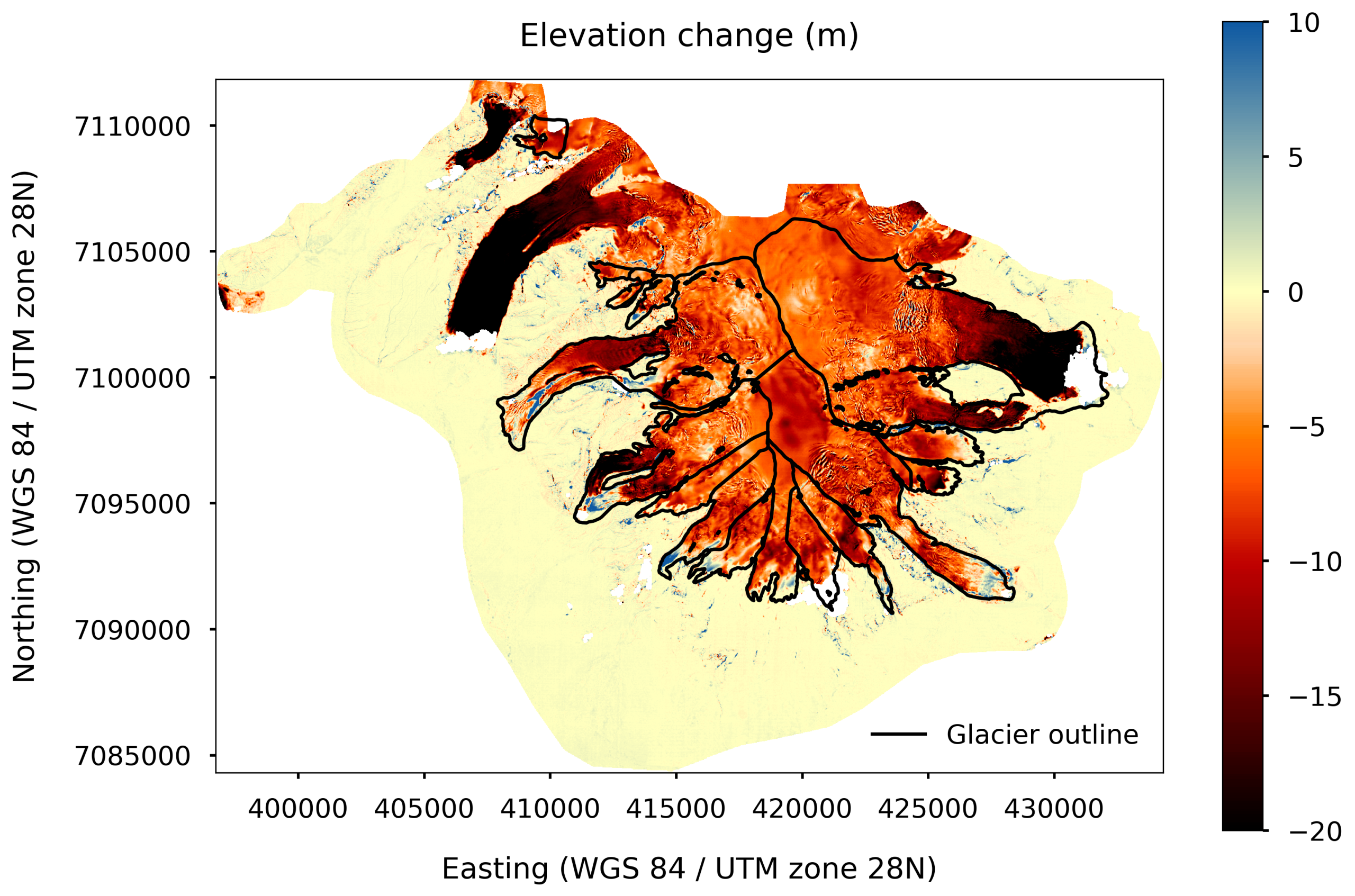
Videma, Andes, 2021-2026

South Orkney Islands, Antarctic Periphery, 2021-2026

Pascua Lama, Andes, 2020-2026

Olivine, New Zealand, 2020-2026

Marinelli Glacier, Southern Andes, 2021-2026

Glaciar De Los Tres, Southern Andes, 2020-2026

Fiordland, New Zealand, 2020-2026

Domuyo, Andes, 2020-2026

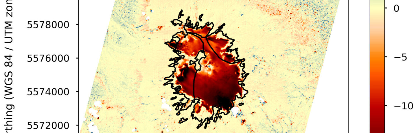
Davies Dome, Antarctic Periphery, 2020-2026

Davies Dome, Antarctic Periphery, 2020-2026