A pre-print describing the PGO program is online for public discussion & review

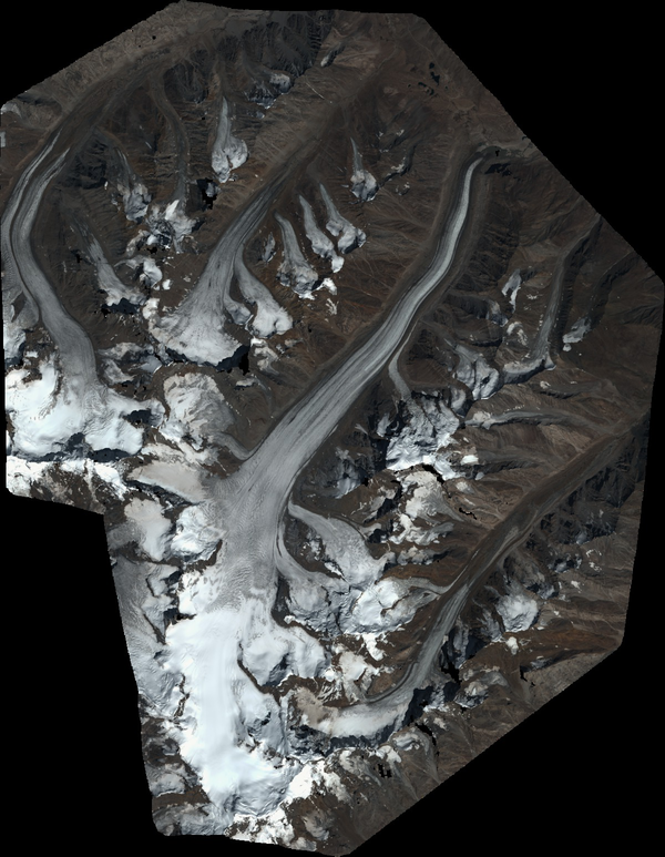
We just submitted to The Cryosphere (EGU) a manuscript describing the Pléiades Glacier Observatory (PGO) initiative, the data provided to the community. An effort was made to assess the precision of the topographies and elevation change maps derived from these data, in particular using synchronous Lidar data from Norway and Canada. A pre-print is available in EGUsphere for open discussion until 3 April 2024. Comments more than welcome.

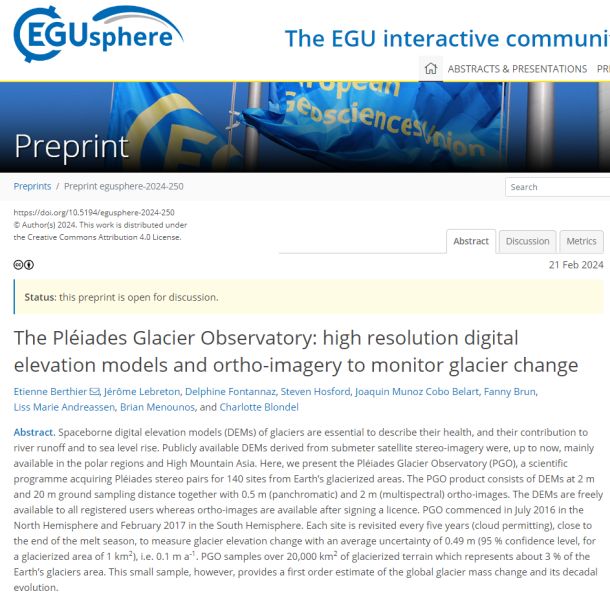
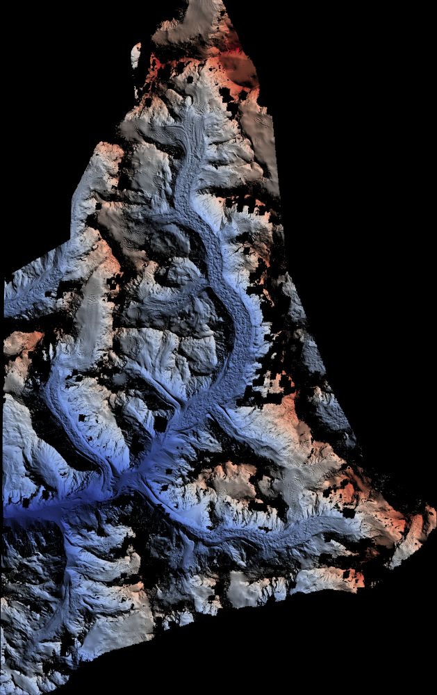
Berthier, E., Lebreton, J., Fontannaz, D., Hosford, S., Belart, J. M. C., Brun, F., Andreassen, L. M., Menounos, B., and Blondel, C.: The Pléiades Glacier Observatory: high resolution digital elevation models and ortho-imagery to monitor glacier change, EGUsphere [preprint], https://doi.org/10.5194/egusphere-2024-250, 2024.

Plus d'actualités

Beyond Pléiades. 4D-Earth ?

Pléiades will be flying until 2026, maybe slightly later. Another key stereo mission, ASTER on-board TERRA, will stop acquiring images in 2026 or 2027. A large scientific community (in particular glaciologists) is worried about the lack of follow up stereo missions. See here a Letter to the Editor in Nature. This is why we propose […]

PGO data help to guide fieldwork in the Andes

We are delighted to read that Pléiades ortho-images and DSM were useful to guide a recent field campaign on the Quelccaya Ice Cap. PGO data will certain be also useful for the science to come out of these field observations. Congrtulation to the Deplete and Retreat: Andes Water Towers team.

Map of elevation changes: quick-looks

The ultimate PGO products are the maps of glacier elevation changes over 5-yr periods. They will soon be available on a web server. To keep you waiting, find below a gallery of such maps for 2016-2021, 2017-2022 or 2018-2023. Maybe you can spot your favorite glacier? [click on the first image to start the slideshow] […]

Rechercher