Editors: R. MORROW & E. KESTENARE
The Southern Ocean is a region where many of the ocean’s deep waters are formed or transformed, by the intense air-sea-ice exchanges. The Southern Ocean also provides the main oceanic link between the Pacific, the Atlantic and the Indian Oceans, so its very important to monitor the Southern Ocean transport and water mass changes, since they flow into the other world oceans.
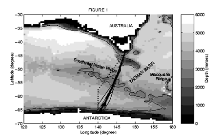
There are very few choke points in the Southern Hemisphere at which to measure the circulation of the Southern Ocean, and the inter-ocean exchange between the Pacific, the Indian and the Atlantic Oceans. The three main choke points are at Drake Passage south of South America between Tierra Del Fuego and the Antarctic Peninsula, south of South Africa and south of Tasmania, Australia.
South of Tasmania, the IPEV (Institute Polaire Emile Victor), and its predecessor agency, have been operating a supply service between Hobart and the French Antarctic island base, Dumont D’Urville, which is a research facility in its own right. The Antarctic supply ship L’Astrolabe, also the name of Dumont D’Urville’s vessel during his 1840 journey into the Southern Ocean, has been providing this service since 1988, ferrying expeditioners, equipment and supplies for both Dumont D’Urville and Concordia Dome C Antarctic operations.
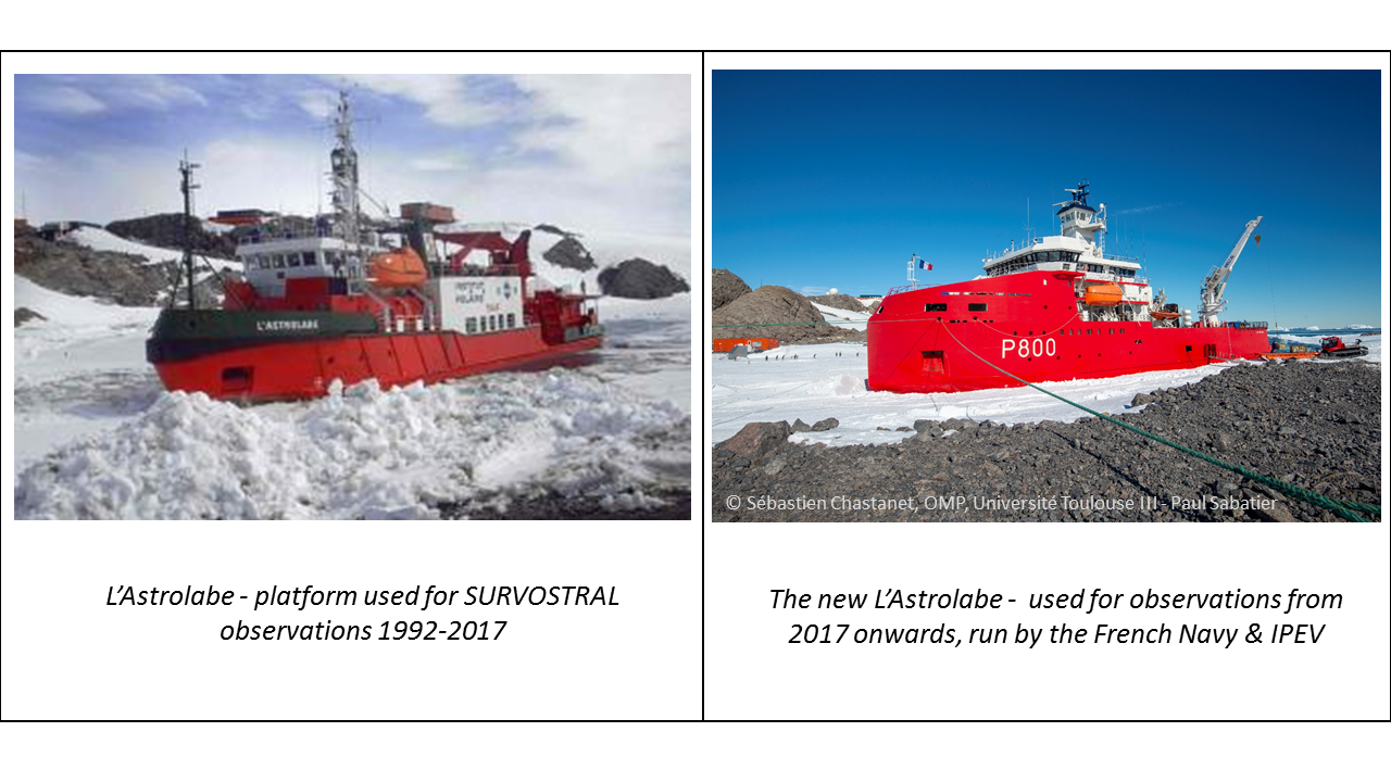
The regular summer service along a direct route between Hobart and Dumont D’Urville offered a marvellous opportunity for scientists to measure the upper ocean thermal characteristics and the ocean’s surface salinity on a regular basis, using technology developed in the 1980’s and still used around the world on commercial shipping routes as a tool of ocean observation. With few shipping services in the Southern Ocean, l’Astrolabe’s Antarctic service, monitoring upper ocean temperature and surface salinity, has become an integral component for long-term climate and ocean observations.
In a warming climate, our models indicate that the Southern Ocean is warming at depth, and the freshwater cycle is increasing so that the surface layers are becoming more saline in the subtropics, and have more freshwater circulating at higher latitudes. The details of these changes need observational validation, yet the hostile conditions in the Southern Ocean lead to sparsely distributed historical observations.
Since 1992/1993, the Survostral project takes upper ocean measurements from the four to six Astrolabe supply services made each austral summer, starting in October and concluding in early March, giving scientists a unique opportunity to obtain temperature data from the upper one kilometre of the Southern Ocean. The project uses high-resolution eXpendable BathyThermograph probes (XBTs), launched every 20-35 km along the ship’s route, as well as surface temperature and salinity observed continually using a thermosalinograph (TSG). These observations show the detailed seasonal and interannual changes occurring over the rapidly changing upper 800 m depth. Full-depth hydrographic observations are measured nearby every few years on the WOCE SR3 line, monitoring the slower, deeper changes (see Figure below).
Southern Ocean researchers Dr Rosemary Morrow and Elodie Kestenare, from the French oceanographic laboratory, LEGOS and Dr Steve Rintoul and Rebecca Cowley from the Australian CSIRO, currently lead the project in support of their climate studies