Andreassen et al.: Validation of Sentinel-2 based glacier mapping in Norway using Pléiades satellite orthoimages
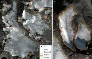
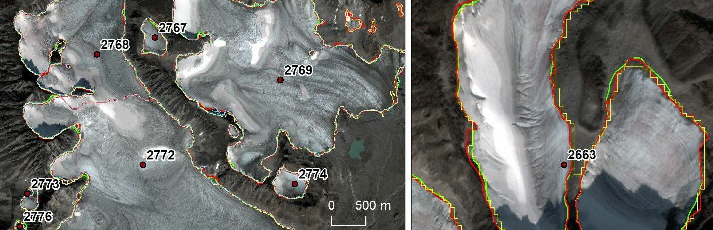
In this study Sentinel-2 satellite imagery at 10 m resolution was used to map the extent of Norway’s glaciers and ice-marginal lakes over 2018–19. A standardized semi-automated band ratio method was applied to derive glacier outlines and ice-marginal lakes. The Sentinel-2 derived outlines were checked with very high-resolution aerial orthophotos and Pléiades satellite orthoimages. Glaciers larger than 0.3 km2 have area differences within 7%, whereas values are larger for smaller glaciers. The orthophotos and orthoimages provide more details and a higher mapping accuracy for individual glaciers, but require manual digitalisation, have smaller spatial and temporal coverage and can have adverse snow conditions. The total glacier area of Norway was 2328 ± 70 km2 which the ten largest glaciers accounted for 52%. The glacier area decreased 15% since the previous inventory (Landsat data from 1999 to 2006), the reduction being largest in northern Norway (22%) compared to southern Norway (10%). We detected more than 2000 previously undetected smaller glaciers and ice patches (covering 37 km2) and 360 new ice-marginal lakes.
Andreassen, L.M., T. Nagy, B. Kjøllmoen, J.R. Leigh. 2022. An inventory of Norway’s glaciers and ice-marginal lakes from 2018–19 Sentinel-2 data. Journal of Galciology, Glaciology, 1–22. https://doi.org/10.1017/jog.2022.20