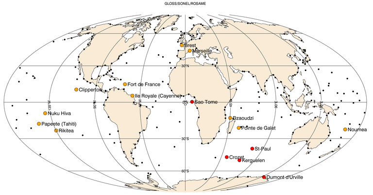
Orange : French tide gauges. Red : ROSAME network and Sao Tomé tide gauge.
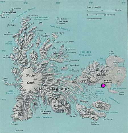
Kerguelen
Kerguelen tide gauge(-49° 20.7′ South, 70° 13.2′ East) is localized along the wharf of Port aux Français, the french scientific base of Kerguelen. It was installed in 1993. It contains a MarArgos 200 automatic tide gauge station which activates, every hour, measurements of:– atmospheric pressure with an Orion sensor;– bottom pressure, sea water temperature and […]
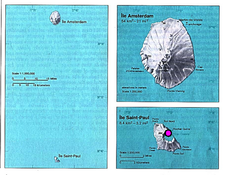
Saint-Paul
Saint-Paul tide gauge (-38° 42.7′ South, 77° 32.3′ East) s situated in the crater of a partially immersed volcano which communicates with ocean. It was installed in 1994. It contains a PM36S MarArgos automatic tide gauge station which activates, every 20 mn, measurements of:– atmospheric pressure with a Vaisala sensor;– bottom pressure, sea water temperature […]
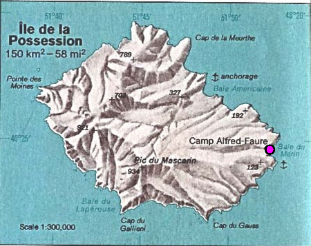
Crozet
Crozet tide gauge (-46° 25.5′ South, 51° 52.2′ East) is settled on the Possession island in Crozet archipelago. It was installed in 1995. It contains a DTINSU automatic tide gauge station which activates, every 20 mn, measurements of: atmospheric pressure with a Vaisala sensor; bottom pressure with a Paroscientific sensor, sea water temperature and conductivity […]
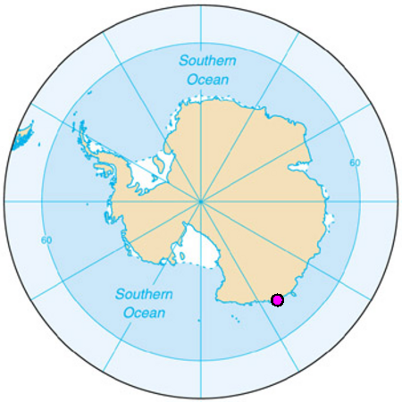
Dumont d’Urville
Dumont d’Urville tide gauge (-66° 39.7′ South, 140° 00.6′ East) is situated near the french scientific base of Dumont d’Urville in Antarctica. It was installed in 1997. It contains a PM36S MarArgos automatic tide gauge station which activates, every 20 mn, measurements of: atmospheric pressure with a Vaisala sensor; bottom pressure, sea water temperature and […]