Altimetry ocean topography measurement is a major component of international programs (GOOS, WOCE, CLIVAR, GLOSS, …) which explain the motivation for altimetric missions (Topex/Poseidon, ERS-1/2, JASON1, ENVISAT, …). Then, with these altimetric measurements, the in situ measurement is absolutely necessary:
- to provide time series, a point in space but continuous in time, so as to compare with alimetry, synoptic but discontinuous in time;
- to contribute to the altimetry measurement validation;
- to allow to link altimetric mesasurements from one satellite to a differente but sucessive satellite.
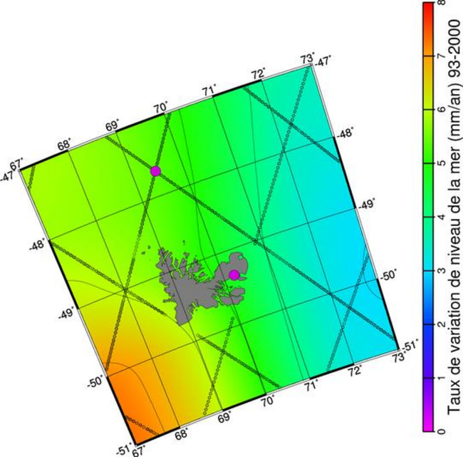
ROSAME contributes to this three point by providing accurate data in regions of sparse tide gauge data: the South Indian Ocean. These data were compared with the Topex/Poseidon altimetric measurements near the ROSAME observation sites. Measurement agreement is good for the Crozet site and very good for the Amsterdam site. For the Kerguelen site, the comparisons are more complex due to the continental shelf extension in this area. However this tide gauge was choosen as a reference among a 30 tide gauge network of GLOSS so as to calibrate satellite altimetric missions over a long period.